


Active Topics
-
TLS 1.2 for N9 is ready (21)
to MeeGo / Harmattan by shakolan - 22 hrs, 22 mins ago -
Pinephone and Pinephone Pro on Leste vs Mobian (2)
to Maemo 7 / Leste by biketool - 23 hrs, 23 mins ago -
Sailfish OS on Sony Xperia X Compact (community build) (210)
to SailfishOS by aspergerguy - 2 days, 18 hrs ago -
Facebook chat on Nokia N9 - back to life :) (41)
to MeeGo / Harmattan by shakolan - 4 days, 17 hrs ago -
Any chance to get back mirror.thecust.net ? (3)
to MeeGo / Harmattan by dredlok706 - 4 days, 17 hrs ago - more...

|
2013-04-19
, 15:58
|
|
Posts: 19 |
Thanked: 10 times |
Joined on Apr 2013
|
#1352
|
Got it, sorry, forgot about that extras-devel option. Still the latest version is very slow loading tracks and navigating on map.
Try yourself one of the Tour Divide maps from: http://topofusion.com/divide/gps.php
Try yourself one of the Tour Divide maps from: http://topofusion.com/divide/gps.php
| The Following User Says Thank You to gsever100 For This Useful Post: | ||

|
|
2013-04-24
, 19:38
|
|
Posts: 1,548 |
Thanked: 7,510 times |
Joined on Apr 2010
@ Czech Republic
|
#1354
|
Sorry for the late answer. 
My plan is to add a button for setting the theme from QML + add your icons and then release it.
The hardcoded values you see - the one in PinchMap is a default for all PinchMap elements and the one in MapPage is just default for the PinchMAp instance on MapPage (bit redundant as it is the same as the default for all PinchMaps).
BTW, as the QML UI still does not remember selected layers, you can just hardcode them in MapPage for now. Notation for the current modRana version would look like this:
BTW, I've even tried how fast it would be to do the negative in pure Python and it was about 900ms for one 256x256 tile. With PIL, it is almost instant.
ModRana processes every GPS tracklog it loads internally to a series of nearby point clusters. Then it only cares about the points in the clusters that are currently visible.
On the other hand, if the whole track is on screen, it indeed draws all the 10k points. Which is arguably not very fast.
There is certainly room for improvements, such as simplifying the track at zoom levels - modRana already does this for the track logging trace, just not for tracklogs. BTW, now when I think about it, I haven't touched the tracklog drawing code in about 2,5 years. I think it is about time I do something about it.
BTW, last Saturday, I made modRana Python 3 compatible with these 60 commits. Of course it is also still fully compatible with Python 2.5 on Maemo and works just fine on the N900 as usual.
This was needed mostly due to the BB10 port, as there is only Python 3.2 available out of the box on that platform. Of course might come in handy elsewhere as platforms slowly migrate to Python 3.
Originally Posted by Wikiwide

The latest code in Git already has theming support in QML, just not any user interface for it just now.
Quick reply...
Thank you, but I am not updating until night theme is usable in QML GUI (and mode image is used for the menu button).
My plan is to add a button for setting the theme from QML + add your icons and then release it.
Originally Posted by Wikiwide
It is basically like this - PinchMap is a stand alone map element/widget and MapPage is the page that is showing a full screen version of the map element/widget. Currently, only MapPage is using PinchMap, but in the future, it should show up in various places, like overview maps for POIs or search results or maybe a small "orientation" map that would show a larger area around your location.
For now, a question: therearewere hard-coded values for "layers" in both PinchMap.qml and MapPage.qml. However, MapPage.qml values take precedence, as I found out while hard-coding my preferred values of mapnik-0.5 and vaer-0.5.
The hardcoded values you see - the one in PinchMap is a default for all PinchMap elements and the one in MapPage is just default for the PinchMAp instance on MapPage (bit redundant as it is the same as the default for all PinchMaps).
BTW, as the QML UI still does not remember selected layers, you can just hardcode them in MapPage for now. Notation for the current modRana version would look like this:
Code:
        layers : ListModel {
            ListElement {
                layerName : "Virtual Earth"
                layerId: "vaer"
                layerOpacity: 1.0
            }
            ListElement {
                layerName : "OSM Mapnik"
                layerId: "mapnik"
                layerOpacity: 0.5
            }
        }
Originally Posted by Wikiwide
Well, they are configured to jump by 10%, which IMHO should be a good compromise for not having to show an opacity value for each layer. Also, it should be quite easy to set stuff like 50% or to set the same value for multiple layers - there are not that many steps. Now when I think about it, just having 0%, 25% 50%, 75% and 100%, like in GTK GUI, might also do.
By the way, the slider for opacity can be somewhat annoying, especially when there is no way to check the exact value of opacity. Not that important, though, when I can simply hard-code them instead of going through Graphical-User-Interface.
Originally Posted by Wikiwide
That's a good question. The negative filter in GTK GUI is using the Python Imaging Library bot something with only Qt as dependency for the QML GUI would be nice.
Best wishes. Will post a screenshot later, probably. I am looking for filter-negative for QML Image.
_________________
Per aspera ad astra...
BTW, I've even tried how fast it would be to do the negative in pure Python and it was about 900ms for one 256x256 tile. With PIL, it is almost instant.
Originally Posted by gsever100
Zoom in.
Hi Martin,
I have compared various mapping tools exists on N900 and concluded that this is the most feature-rich and most actively developed one. However, it is slow comparing to Mappero, especially when I overlay a long track (A GPX file with 10K) makes the app and phone unresponsive. Is there any developments in this regard?
Thanks.
ModRana processes every GPS tracklog it loads internally to a series of nearby point clusters. Then it only cares about the points in the clusters that are currently visible.On the other hand, if the whole track is on screen, it indeed draws all the 10k points. Which is arguably not very fast.
There is certainly room for improvements, such as simplifying the track at zoom levels - modRana already does this for the track logging trace, just not for tracklogs. BTW, now when I think about it, I haven't touched the tracklog drawing code in about 2,5 years.
I think it is about time I do something about it.
Originally Posted by gsever100
Sure, good testing data is always welcome.
Try yourself one of the Tour Divide maps from: http://topofusion.com/divide/gps.php
Originally Posted by nokiabot
A bit busy at the moment with finishing my masters thesis.
Hey martink howslife !
BTW, last Saturday, I made modRana Python 3 compatible with these 60 commits.
Of course it is also still fully compatible with Python 2.5 on Maemo and works just fine on the N900 as usual. This was needed mostly due to the BB10 port, as there is only Python 3.2 available out of the box on that platform. Of course might come in handy elsewhere as platforms slowly migrate to Python 3.
__________________
modRana: a flexible GPS navigation system
Mieru: a flexible manga and comic book reader
Universal Components - a solution for native looking yet component set independent QML appliactions (QtQuick Controls 2 & Silica supported as backends)
modRana: a flexible GPS navigation system
Mieru: a flexible manga and comic book reader
Universal Components - a solution for native looking yet component set independent QML appliactions (QtQuick Controls 2 & Silica supported as backends)
|
|
2013-05-05
, 10:48
|
|
Posts: 1,548 |
Thanked: 7,510 times |
Joined on Apr 2010
@ Czech Republic
|
#1355
|
modRana 0.41.1 has been released !
What's new ?
QML GUI improvements
The QML GUI now supports theming and in Options->UI (the options menu finally does something, yay ! ) you can enable showing mode icon on the menu button.
Android support
ModRana QML now works on Android ! Due to the Android porting work I worked on at the start of the year & due to all the wonderful improvements Aaron Richiger did on it (thanks a lot !),
modRana now works on Android and can be also easily packaged for it. BTW, for more info about making Python applications for Android see the guide & the pydroid project.
The installation package is available here:
http://modrana.org/packages/android/modrana_0.41.1.apk
The package is standalone and you can just install it on your Android device as any other Android package. As it uses Qt and you have not yet installed any Qt applications on your device, it will point you to Google Play to install the Ministro Qt library manager. Once you do that, everything will continue automatically. The APK supports Android 2.2 and up, so it should work on more than 95% of all Android devices.
Please note that this package being the initial modRana QML release for Android, there might still be some rough edges here and there. Also, GPS is not yet supported, so it is basically a very fancy map viewer for now.
Some further notes:
Python 3 support
ModRana now works with Python 3, shile still being Python 2.5. As a result, it still works just fine on the N900, but should also work with Python 3.2 on BlackBerry 10 once I finally get to packaging it.
Screenshots

modRana running on the HP TouchPad with Android

the main map screen on Android in landscape

main map screen in portrait on Android showing showing a couple of overlaid map layers

this is how it looks like when you minimize modRana on Android

the theme switcher & co

the new night theme
for comparison, the same screen with the default theme

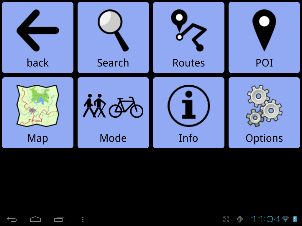
eventually, there should be two sets of icons - black ones for the default theme and white ones for the night theme, the mode menu is the first one completely converted
Changelog
What's new ?
QML GUI improvements
The QML GUI now supports theming and in Options->UI (the options menu finally does something, yay !
) you can enable showing mode icon on the menu button.Android support
ModRana QML now works on Android ! Due to the Android porting work I worked on at the start of the year & due to all the wonderful improvements Aaron Richiger did on it (thanks a lot !
), modRana now works on Android and can be also easily packaged for it. BTW, for more info about making Python applications for Android see the guide & the pydroid project.
The installation package is available here:
http://modrana.org/packages/android/modrana_0.41.1.apk
The package is standalone and you can just install it on your Android device as any other Android package. As it uses Qt and you have not yet installed any Qt applications on your device, it will point you to Google Play to install the Ministro Qt library manager. Once you do that, everything will continue automatically. The APK supports Android 2.2 and up, so it should work on more than 95% of all Android devices.
Please note that this package being the initial modRana QML release for Android, there might still be some rough edges here and there. Also, GPS is not yet supported, so it is basically a very fancy map viewer for now.
Some further notes:
- after installation, the APK (Android stores them for some reason) & modRana take up together about 50 MB due to all the depndencies that need to be bundled (Python, PySide, Qt Components)
- map tiles are stored in /sdcard/modrana/maps
- screen size is detected automatically on startup and automatic screen rotation is supported
- modRana looks really good when running on a tablet !
Python 3 support
ModRana now works with Python 3, shile still being Python 2.5. As a result, it still works just fine on the N900, but should also work with Python 3.2 on BlackBerry 10 once I finally get to packaging it.
Screenshots
modRana running on the HP TouchPad with Android
the main map screen on Android in landscape
main map screen in portrait on Android showing showing a couple of overlaid map layers
this is how it looks like when you minimize modRana on Android
the theme switcher & co
the new night theme
for comparison, the same screen with the default theme
eventually, there should be two sets of icons - black ones for the default theme and white ones for the night theme, the mode menu is the first one completely converted
Changelog
Code:
* Sat May 04 2013 Martin Kolman - 0.41.1
- modRana is now Python 3 compatible
 - Python 2.5 compatibility was of course preserved
 - as a result, modRana still works just fine with Python 2.5 on the N900
 - Python 3 compatibility should enable packaging modRana for BlackBerry 10
- Android compatibility
 - modRana with the QML GUI now works on Android
 - Android device module has been added
 - installable APKs are available
 - APK generation script was added to the modRana packaging scripts
 - map data are stored in /sdcard/modrana/maps
- QML GUI improvements
 - theme switching support
 - night theme for the QML GUI
 - the menu button can now show current mode, as in GTK GUI
 - thanks to Wikiwide for the idea & icons ! :)
 - finally some buttons in Options (related to theme switching & menu icon configuration)
 - fixed centering to the middle of the Atlantic at startup (center on Brno instead :) )
 - fixed main map icon now shows only one map layer
- automatic tile downloading in GTK GUI should now be faster due to connection reuse provided by Urllib 3
- new POI icon
- various fixes
__________________
modRana: a flexible GPS navigation system
Mieru: a flexible manga and comic book reader
Universal Components - a solution for native looking yet component set independent QML appliactions (QtQuick Controls 2 & Silica supported as backends)
modRana: a flexible GPS navigation system
Mieru: a flexible manga and comic book reader
Universal Components - a solution for native looking yet component set independent QML appliactions (QtQuick Controls 2 & Silica supported as backends)
| The Following 19 Users Say Thank You to MartinK For This Useful Post: | ||
|
|
2013-05-05
, 11:01
|
|
Posts: 330 |
Thanked: 556 times |
Joined on Oct 2012
|
#1356
|
I haven't used GPS on my N900 yet, but I am going to do so shortly, and I will use modRana. What an awesome and flexible program, thank you for the continued development!
Quick question: Is there a way to save maps for a specific region? Like all maps in the U.S. or in California, or within 100 miles of a specific route? And can this be done with different maps, like OpenStreet Maps and Google Maps? I don't have a data plan, and downloading map tiles for offline use would be perfect.
Thanks again for this awesome program!
|
|
2013-05-05
, 17:24
|
|
Posts: 159 |
Thanked: 217 times |
Joined on Oct 2011
|
#1357
|
There is the download button in the menu, where you can find the options for downloading maps around your location, view or route. I think it downloads the map you are currently using, so just change that to the one you want to download.
| The Following 3 Users Say Thank You to Kossuth For This Useful Post: | ||
|
|
2013-05-05
, 18:09
|
|
Posts: 330 |
Thanked: 556 times |
Joined on Oct 2012
|
#1358
|
Originally Posted by Kossuth
Really? That simple? modRana is incredible. I'll look into this, thanks!
There is the download button in the menu, where you can find the options for downloading maps around your location, view or route. I think it downloads the map you are currently using, so just change that to the one you want to download.
EDIT: I see this is mentioned also in the first post. Shame on me for not reading it.

Last edited by malfunctioning; 2013-05-05 at 18:13.
|
|
2013-05-05
, 19:07
|
|
Posts: 2,290 |
Thanked: 4,134 times |
Joined on Apr 2010
@ UK
|
#1359
|
Is there any chance of downloadable map packs for ModRana?
It can be a pain downloading around this area at different zoom levels.
In past tests if you set to download maximum amount of tiles for around my area, it slows the system down so much it becomes unresponsive.
It can be a pain downloading around this area at different zoom levels.
In past tests if you set to download maximum amount of tiles for around my area, it slows the system down so much it becomes unresponsive.
__________________
Wiki Admin
sixwheeledbeast's wiki
Testing Squad Subscriber
- mcallerx - tenminutecore - FlopSwap - Qnotted - zzztop - Bander - Fight2048 -
Before posting or starting a thread please try this.
Wiki Admin
sixwheeledbeast's wiki
Testing Squad Subscriber
- mcallerx - tenminutecore - FlopSwap - Qnotted - zzztop - Bander - Fight2048 -
Before posting or starting a thread please try this.
| The Following 4 Users Say Thank You to sixwheeledbeast For This Useful Post: | ||
|
|
2013-05-05
, 19:20
|
|
Posts: 330 |
Thanked: 556 times |
Joined on Oct 2012
|
#1360
|
Originally Posted by sixwheeledbeast
Although I still haven't tried doing this, I'll believe you, and agree that downloadable maps might be a good idea.
Is there any chance of downloadable map packs for ModRana?
It can be a pain downloading around this area at different zoom levels.
In past tests if you set to download maximum amount of tiles for around my area, it slows the system down so much it becomes unresponsive.
If modRana has a i386 Linux version, I suppose this process could be done also in a PC.
I have a question, which will probably reveal my absolute lack of knowledge in this area: What modRana needs to navigate and give directions is embedded in the map data, but that metadata is separate from the graphic tiles? Because it would be a good idea to just download that metadata without downloading the tiles (or just downloading very low resolution tiles) and it seems it would save a lot of space. If you have voice navigation this would even make more sense.
Does modRana even need any tiles to be able to give directions?
| The Following 4 Users Say Thank You to malfunctioning For This Useful Post: | ||
 |
| Tags |
| bada rox, martin_rocks, modrana, navigation, openstreetmap, the best, wehasgps |
«
Previous Thread
|
Next Thread
»
|
All times are GMT. The time now is 08:08.
http://talk.maemo.org/showthread.php...21#post1330621